
A sprawling storm system is slamming large parts of the country with a messy mix of snow, ice, strong winds, heavy rain, and even lightning. As it pushes east, it is creating major headaches for travelers and putting millions under winter weather alerts at one of the busiest times of the year.
As of Sunday, December 28, 2025, about 52 million people were under some form of winter weather alert, stretching from the northern Plains all the way to New England.
Flight Delays and Cancellations Pile Up
Air travel took an immediate hit as conditions worsened. By midday Sunday, more than 6,000 flights were delayed and over 500 were canceled for trips flying into or out of the United States.
The Federal Aviation Administration also issued a ground delay at Minneapolis–Saint Paul International Airport due to weather. The delay was expected to remain in place until 11:59 p.m. CT, with average delays running around 3 hours and 9 minutes.
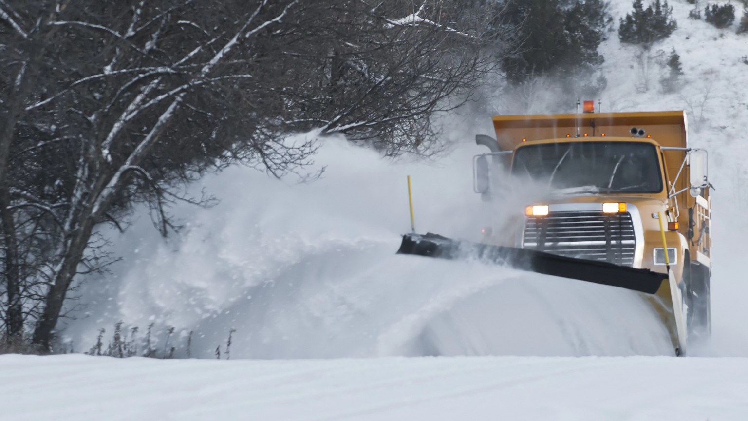
Snow, Rain, Wind, and Lightning Create a Coast-to-Coast Mess
The storm’s impact has not been limited to one region. On Sunday morning, snow fell in parts of Colorado, Wisconsin, and Minnesota, while rain pushed from Iowa into the Ohio Valley. Some areas saw gusty winds and lightning mixed into the rain, adding another layer of disruption.
In the Minneapolis area, conditions turned especially intense. Video from Sunday morning showed heavy snow falling onto ground that was already coated in snow, a sign that accumulation was building quickly as the system moved through.
Severe Storm Threat Builds for Sunday Evening
Forecasters expected another surge of trouble later Sunday, with a strong line of storms projected to develop from the Great Lakes down into the mid-South. That setup raised the risk of new travel delays in major hubs such as Chicago, Indianapolis, Detroit, and Memphis.
Across parts of Illinois, Indiana, and northwest Kentucky, roughly 5 million people remained under a slight risk for severe weather. That threat included the potential for damaging wind gusts, large hail, and multiple tornadoes.
By Sunday afternoon, at least five preliminary storm reports had already come in from central Illinois, showing the system was capable of producing impacts before the most intense evening storms arrived.
Widespread Wind Alerts Stretch Across the Country
Even for travelers outside the heaviest snow or ice, wind alone became a major concern. Wind alerts covered about 138 million people nationwide, with gusts expected to range from 35 to 45 mph in many areas. Some locations could see gusts jump to 65 mph.
Cities potentially affected included Dallas, New Orleans, St. Louis, Chicago, Buffalo, and Philadelphia, meaning both air travel and road travel could be affected well beyond the snowbelt.
Blizzard Conditions Possible in the Upper Midwest
The system was expected to continue producing snow and rain across the Midwest and Great Lakes Sunday afternoon, with impacts lingering into Monday morning.
In parts of Iowa, Minnesota, and the Dakotas, the combination of high snowfall rates and 40 mph wind gusts could create blizzard conditions, making driving dangerous and reducing visibility quickly. Wisconsin and the Upper Peninsula of Michigan were also expected to see hazardous travel conditions overnight.
More Snow for Michigan and the Eastern Great Lakes
As the storm wraps around, another round of snow was expected to target parts of Michigan and the eastern Great Lakes through Monday. After that, lake effect snow bands were forecast to keep going downwind of Lake Erie and Lake Ontario through Tuesday.
Those lake effect bands could bring 3 to 6 inches of snow in many places, with pockets reaching up to 14 inches where the bands set up and linger.
In the Upper Midwest, snowfall totals were expected to land in the 3 to 9 inch range, with isolated areas potentially getting as much as 20 inches.
Ice and Freezing Rain Push Into the Northeast
While parts of the Midwest battled heavy snow, freezing rain became a growing issue farther east. On Sunday afternoon, freezing rain was already hitting parts of Pennsylvania and New York, and it was expected to push deeper into the Northeast overnight.
Forecasters expected the system to linger over New England through Monday evening, then move offshore by early Tuesday morning.
The biggest concern in the Northeast was ice accumulation. Hazardous travel conditions and power outages were possible from northern Pennsylvania through Maine, as ice buildup could reach roughly 0.2 to 0.5 inches in some areas.
What Travelers Should Expect Next
With a storm this large, disruptions tend to ripple outward. Snow and ice can slow down highways, reduce visibility, and create spinout conditions, while strong winds can delay flights and complicate airport operations even when runways clear. Meanwhile, severe storms in the Great Lakes and mid-South could trigger sudden ground stops and new delays later in the day.
If you are traveling Sunday into Monday, expect changing conditions and check ahead often. Flight boards, road reports, and local alerts can shift quickly as the storm slides east and the hazards change from snow to wind to ice.
Follow us on MSN for all your travel and lifestyle tips.
This article was written by Hunter and edited with AI Assistance